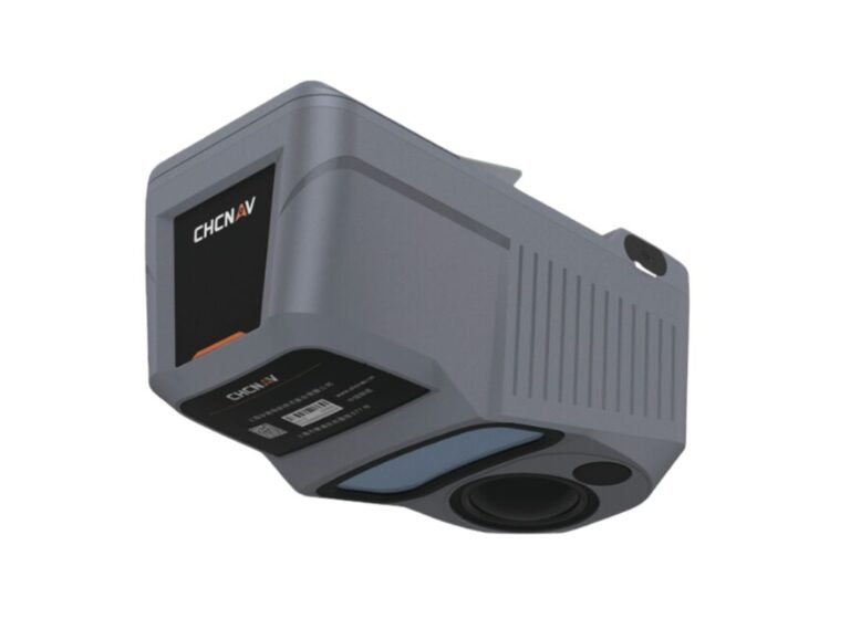
CHCNAV Alpha Air 10
PROFESSIONAL AIRBORNE SURVEY LiDAR

Introduce CHCNAV Alpha Air 10
AA10 is a new generation of intelligent aerial surveying system from CHCNAV. It is the result of six years of innovation and three years of product development, powered by CHCNAV’s state-of-the-art LiDAR technology. It integrates survey-grade high-precision LiDAR, accurate positioning and orientation system, and a full-frame industrial camera. Combined with CHCNAV’s pioneering point cloud & image fusion modeling algorithm, it provides survey-grade, highly efficient, and cost-effective 3D data capturing and processing throughout the entire CHCNAV workflow. A single mission with AA10 allows for fast and accurate acquisition of 3D data, revolutionizing traditional aerial survey techniques and bringing about a new breakthrough in the aerial survey industry.
Detail Parameters
more detail about UAV LiDAR CHCNAV Alpha Air 10 and Specifications
Absolute Hz Accuracy
2 cm ~ 5 cm RMS
Absolute Z accuracy
2 cm ~ 5 cm RMS
Weight of instrument
1.55 Kg
Dimensions of Instrument
210 mm x 112 mm x 131 mm
Data Storage
512 GB
GNSS System
GPS: L1, L2, L5 GLONASS: L1, L2
BEIDOU: B1, B2, B3 GALILEO: E1, E5a, E5b
Camera type
45 MP
IMU update
rate 500 Hz
Input Voltage
DC 24 V (13 ~ 27 V)
Power Consumption
40 W
Power Source
Depending on UAV battery or by Skyport (DJI M300/M350)

