CHCNAV Alpha Air 9
The AA9 simplifies the process of capturing 3D reality through a streamlined workflow.

Introduce CHCNAV Alpha Air 9
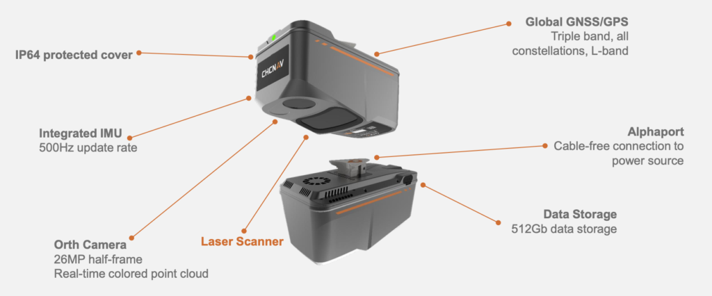
Advanced aerial surveying solution featuring LiDAR and RGB sensors to meet the needs of professional UAV LiDAR mapping and drone photogrammetry. The AA9 flawlessly integrates high-precision CHCNAV’s LiDAR, accurate GNSS positioning, IMU orientation and an industrial-grade half-frame orthophoto camera. Combined with CHCNAV point cloud and image fusion modeling software, the AA9 provides a survey-grade, efficient and cost-effective approach to 3D data acquisition and processing.
CHCNAV AA9 OVERVIEW
NEW GENERATION OF LIGHTWEIGHT AIRBORNE LIDAR+RGB SYSTEM

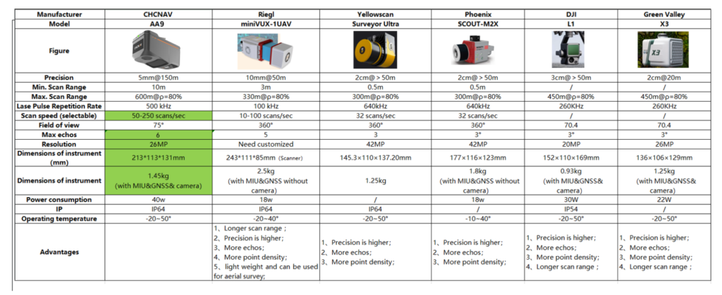
CHCNAV AA9 COMPETITORS

Detail Parameters
more detail about UAV LiDAR CHCNAV Alpha Air 9 and Specifications
Absolute Accuracy
5 cm @ 150 m
Scanning Range
up to 600 m
Weight of instrument
1.45 Kg
Protection Level
IP64
Data Storage
512 GB
GNSS System
GPS, GLO, GAL, BDS, SBAS, QZSS, L-band
Camera type
26 MP
IMU update
rate 500 Hz
Scanner Linear Accuracy
15 mm

